Belize Climate: Seasons, Rainfall, and What Travelers Should Know
Belize’s climate is more than just weather — it’s the rhythm of life. It decides when farmers plant corn, when fishermen set traps for lobster, when whale sharks arrive, and when travelers walk the beaches or climb the Maya Mountains. Growing up here, I learned to read the climate not from charts, but from the sound of rain on the zinc roof, the mist rolling off the mountains, and the sudden change in the river’s color after a storm.
What Kind of Climate Does Belize Have?
Belize has a tropical climate — warm temperatures year-round, with two distinct seasons:
- Dry Season (December–May): Blue skies, lower humidity, and cooler evenings.
- Rainy (Green) Season (June–November): Hotter, more humid, with heavy afternoon showers that refresh the air.
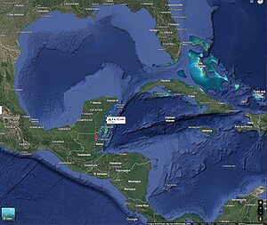
Because Belize sits between the Caribbean Sea and the Maya Mountains, microclimates appear across regions. Coastal areas are moderated by the sea, while inland valleys get hotter by day and cooler at night.
Average Climate Conditions in Belize
- Temperature Range: 70–90°F (21–32°C) year-round
- Rainfall: 60–180 inches (1,500–4,500 mm), depending on region
- Humidity: 75–85% on average
- Sea Temperature: 79°F (26°C) in winter to 86°F (30°C) in summer
Regional Climate Differences in Belize
Though small in size, Belize’s climate changes noticeably depending on where you are:
Northern Belize (Corozal & Orange Walk)
- Hotter and drier, influenced by Yucatán weather.
- Rainfall: 60–80 inches (1,500–2,000 mm).
- Evenings cooled by breezes off the Bay of Chetumal.
Central Coast (Belize City, Cayes, Ladyville)
- Warm and humid year-round with steady Caribbean winds.
- Smaller difference between day and night temps.
- Sudden showers common during green season.
Western Belize (San Ignacio, Cayo District)
- Hot by day, cool by night.
- Rainfall: 80–100 inches (2,000–2,500 mm).
- Valleys trap heat, but evenings drop into the 60s°F (18–19°C) in January–February.
Southern Belize (Dangriga, Hopkins, Toledo)
- The wettest region, with up to 180 inches (4,500 mm) annually.
- Afternoon downpours common, creating lush landscapes.
- Rich agricultural base for cassava, cacao, and plantains.
Maya Mountains & Pine Ridge
- Much cooler, especially at night (mid-60s°F / 18–20°C).
- Misty mornings and cloud forests thrive here.
- Acts as Belize’s “natural air conditioner,” regulating rivers downstream.
Belize Climate and Travel
Climate sets the pace of travel just as much as it sets the pace of farming:
- Best for Beaches & Reef: December–April. Dry, calm seas for snorkeling and diving.
- Best for Jungle & Ruins: February–April. Dry trails, lower river levels, manageable inland heat.
- Whale Shark Season: April–June. This overlaps with Belize’s hottest months and signals spawning season in Placencia.
- Quiet/Budget Season: September–October. Wetter but uncrowded — a great time for solitude.
The Hottest Months in Belize
Since 2010, Belize’s hottest months have been consistently May and June, when average highs reach above 90°F (32°C). These months bring intense sun, high humidity, and sometimes record-breaking temperatures. Travelers often ask: “Is Belize safe during this time?”
The short answer: yes, Belize is safe to visit during the hottest months, but you should take precautions:
- Stay hydrated: The heat is more intense inland, so carry water on hikes or ruins tours.
- Plan activities early or late: Start excursions in the morning or enjoy evenings by the sea.
- Heat & storms: May–June is before peak hurricane season, so storms are rare, but sudden showers can occur.
- General safety: Tourist areas remain welcoming; the main “safety” factor in hot months is managing sun exposure and avoiding heat stress.
Belize’s climate is warm year-round, but with awareness and preparation, traveling even in the hottest months is both safe and rewarding.
Belize Climate Compared to Other Destinations
Travelers often compare Belize to Jamaica, Cancun, or Costa Rica. While all share tropical weather, Belize’s reef, rainforest, and mountains create unique conditions.
| Destination | Avg High (°F/°C) | Avg Rainfall (in/mm) | Hottest Months | Unique Notes |
|---|---|---|---|---|
| Belize | 80–90°F / 27–32°C | 60–180 in / 1,500–4,500 mm | May–June | Dry/rainy split; Caribbean breeze; cooler Maya Mountains |
| Jamaica | 82–91°F / 28–33°C | 40–100 in / 1,000–2,500 mm | Jul–Aug | More humid; longer hurricane exposure; no mountain cooling |
| Cancun | 82–90°F / 28–32°C | 50–60 in / 1,300–1,500 mm | Jul–Sep | Hot late summer; shorter rainy season; flat terrain |
| Costa Rica | 75–88°F / 24–31°C | 80–160 in / 2,000–4,000 mm | Mar–May (Pacific) | Much wetter overall; Pacific influence; diverse microclimates |
Takeaways:
- Belize is hottest earlier (May–June), while Jamaica and Cancun peak later (Jul–Sep).
- Belize has wider rainfall variation — the south rivals Costa Rica’s wetness, while the north is as dry as Cancun.
- Belize is less hurricane-prone than many Caribbean islands.
Climate Hazards and Belize’s Resilience
- Hurricanes: Season runs June–November, though Belize is struck less often than some Caribbean islands.
- Flooding: Rivers rise quickly after storms, especially inland.
- Adaptation: Belize protects over 40% of its land and sea, making climate resilience part of its national identity.
Climate Change in Belize
The signs of climate change are here:
- Hotter peaks: Dry season highs are rising, with May–June the new ceiling.
- Heavier bursts: Rains come faster and harder, instead of steady.
- Sea stress: Coral reefs bleach under warming waters.
Belize may be small, but it has become a global model of resilience by protecting forests, coasts, and reefs that act as buffers against storms.
My Water Research and Climate Observations
I’ve always believed rivers are the truest climate markers. In my own field notes:
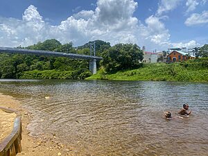
- Dry Season: Rivers like the Macal run lower than when I was a child, exposing rocks I never saw before.
- Green Season: Heavy storms flood valleys overnight, leaving debris high in the trees.
- Water Quality: I’ve tracked algae blooms appearing more often in hotter months, and I’ve watched how dams in the west affect mercury levels and fish health downstream.
Belize’s climate is written in water. From the Monkey River to the Sibun, rivers show us when the land is thirsty, when the mountains release rain, and when the Caribbean tide pushes back.
