Belize and the Caribbean Sea: Geography, History, and Living Culture
Walk with me. I’ll show you what the Caribbean Sea really means — not just on a map, but in our memory, our movement, and our meals.
🌊 Introduction: Not Just Water, But a Way of Life
To most travelers, the Caribbean Sea is turquoise blue, framed by white sand and palm trees. It’s a screensaver. A vacation fantasy. But to us in Belize, it’s more than that.
The Caribbean Sea is where our stories arrived. Where people fled to and floated from. Where food took root, and where identity still drifts along the breeze like salt. It’s the reason you can wake up on a quiet cay eating fry jacks with cassava, or stand on the Placencia shore and hear Garifuna drums from a village where English, Creole, and Kriol all twist together in the heat.
This is not just sea. This is the spirit that shaped us.
🗺️ Where Is the Caribbean Sea? (And Where Does Belize Fit?)
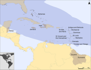
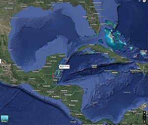
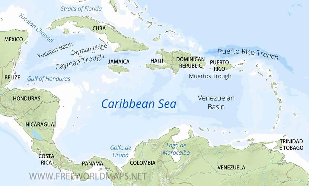
The Caribbean Sea is one of the world’s great inland seas — a vast body of tropical water covering nearly 1.7 million square miles. It is part of the Atlantic Ocean, yet feels like its own world, bounded by three regions of the Americas:
- To the north and east → the arc of islands known as the Greater and Lesser Antilles.
- To the south → the coasts of Venezuela, Colombia, and Panama in South America.
- To the west and northwest → the mainland shores of Central America and Mexico’s Yucatán Peninsula.
And on this western edge sits Belize, where our 240-mile coastline, cayes, and the Belize Barrier Reef all face eastward into the sea.
Belize’s position is unique:
- Geographically → we are part of Central America.
- Culturally → we are firmly Caribbean, tied by sea routes and shared traditions.
- Linguistically → we are the only English-speaking country on the Central American mainland, a legacy of British settlement.
- Geopolitically → we are members of CARICOM (the Caribbean Community), joining hands with our island neighbors.
It was along this coastline that the British Baymen first settled in the 1600s, cutting logwood for shipment across the Caribbean. Their networks linked Belize not inland, but across the sea — to Jamaica, Barbados, and other colonial ports. That history still echoes today: while guidebooks may list Belize in “Central America,” visitors quickly discover that the heartbeat of the Caribbean runs through our coast, music, and daily life.
The very name British Honduras came from geography. It was drawn from the Bay of Honduras, a wide inlet of the Caribbean Sea that touches Belize, Guatemala, and Honduras. This bay was more than a landmark — it was the gateway through which British logwood cutters and privateers entered the region during the 17th century. By attaching “British” to “Honduras,” colonial officials distinguished the settlement from neighboring Spanish Honduras while tying it to the sea that shaped trade, travel, and conflict. The Bay of Honduras became both a practical entry point and a symbolic anchor of Belize’s early colonial identity.
📍 Map Tip: For readers searching “Caribbean Sea on world map,” use two visuals: one global view to show the sea’s size between North and South America, and one closer basin map highlighting Belize’s location on the western rim of the Caribbean.
Hurricanes and the Caribbean Sea
The Caribbean Sea is more than calm turquoise waters. It is also the birthplace and pathway of hurricanes that shape the lives of millions of people.
The Caribbean Hurricane Season and Belt
Every year from June to November, the Caribbean enters hurricane season. The Caribbean hurricane belt stretches from the Atlantic, across the Lesser Antilles, through the central sea, and westward toward Central America. The peak months are August, September, and October, when warm waters and favorable winds combine to fuel the most dangerous storms.
Belize’s Hurricane Season
Here in Belize, hurricanes arrive differently. Because of our position at the western edge of the Caribbean, we see fewer direct hits than the islands to the east. When storms do come, they usually happen later in the season — in October and November. They are often compact and rain-heavy, causing intense coastal damage and inland flooding rather than long-lasting regional destruction.
Belize’s weather also shapes how hurricanes affect us. Average coastal temperatures stay around 27–29°C (80–84°F) year-round, with the hottest months in May–September. By late summer, these warm waters add fuel to storms crossing the Caribbean belt. That is why travelers visiting during September to November should be more aware of forecasts, while those coming in June or July usually face far less risk.
🐠 The Caribbean Sea Shapes Belize’s Geography
Without the Caribbean Sea, Belize wouldn’t look — or feel — like Belize.
- The Belize Barrier Reef
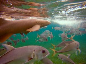
The Caribbean Sea cradles the second-largest reef system in the world, stretching ~190 miles (300 km) along Belize’s coast. It protects our shores, nourishes our marine life, and shapes every island and atoll. UNESCO World Heritage Site mention for the Belize Barrier Reef (inscribed 1996). - Cayes and Atolls
Belize’s famous cayes (like Caye Caulker and Ambergris Caye) are scattered like coral confetti across the sea. They’re not just tourist spots — they’re living communities shaped by trade winds and reef rhythms. - Fishing and Food Security
Generations of Belizeans have depended on the Caribbean Sea for:
* Lobster, conch, and snapper
* Traditional fishing practices like hand-lining and spearfishing
* Cultural events like the annual Lobster Fests
The sea doesn’t just feed our bodies — it feeds our identity.
 The Sea Was Always a Highway: Movement, Trade, and Survival
 The Sea Was Always a Highway: Movement, Trade, and Survival
Before the word “Belize” ever appeared on a passport, the Caribbean Sea was already a pathway for movement.
- Maya Maritime Trade
The Maya moved salt, jade, cacao, and obsidian along rivers and coastal routes, linking inland cities like Lamanai and Altun Ha with sea-facing hubs in northern and southern Belize. - The Garifuna Story
The Garifuna people, descendants of enslaved Africans and Indigenous Kalinago, were forcibly exiled by the British and They first landed in Roatán, Honduras in 1797. From there, groups migrated to Belize, settling by 1802 - British Colonial Routes
The Baymen who first settled Belize came across the Caribbean Sea, using it to extract logwood and mahogany, which were then shipped back to Europe.
Today’s cruise ships follow a similar path — but the story they tell is much shallower.
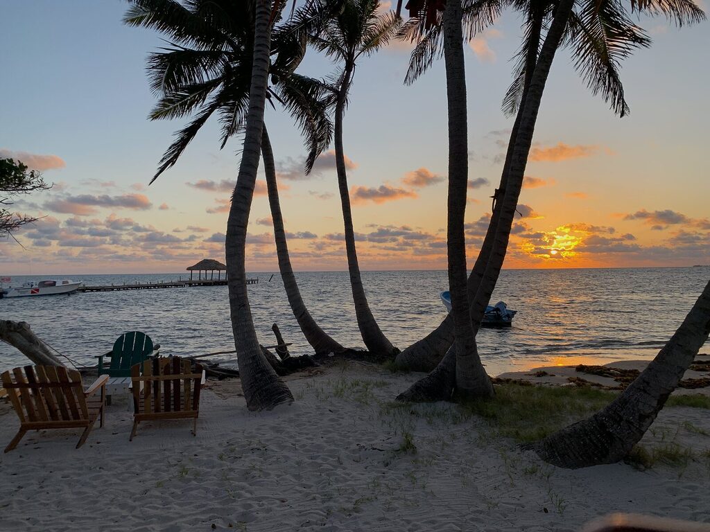
🌴 What the Sea Brought: The Coconut Tree
You can walk almost any coastline in Belize and see a coconut tree standing watch, its roots dug into sand, its fronds dancing with the wind.
But those trees didn’t start here.
They came by sea.
Coconuts are famously buoyant and salt-tolerant, able to float across oceans and sprout when they find land. Long before cargo ships and seed exchanges, coconut seeds drifted on the Caribbean currents, embedding themselves along coastlines from Africa to the Americas.
In Belize, the coconut became:
- Food: grated into rice and beans, stewed into Garifuna hudut
- Medicine: used in bush remedies
- Shelter: fronds used in thatch roofing
- Survival: oil, water, and shade in one plant
The Caribbean Sea brought the coconut — and we’ve made it part of our survival ever since.
It’s a symbol of how much this sea has shaped us — not just by what it took, but by what it gave.
🍛 Caribbean Seasoning, Belizean Spice
You may have searched “Caribbean seasoning” hoping for a list of ingredients. But in Belize, seasoning isn’t just flavor. It’s history on your tongue.
Here’s what Caribbean taste looks like in Belize:
🔥 Key Influences:
- Garifuna: hudut (fish in coconut broth with mashed plantain)
- Creole: rice and beans with stew chicken, Belizean hot sauce, cassava pudding
- Maya: recado rojo, corn tortillas, tamales
- East Indian: curry dishes
- British: meat pies and fruitcakes
- Spanish: escabeche and relleno negro
We season with recado, cumin, allspice, coconut milk, habanero, and lime — but every ingredient has a passport. And the sea carried them here.
🇧🇿 Is Belize a Caribbean Country?
Yes — in culture, language, and soul.
But many travelers are surprised by this. Why?
Because maps label us Central American.
But our national holidays (like Garifuna Settlement Day), our language patterns (Creole, not Spanish), and our music (punta, brukdown) all speak to the Caribbean.
Even our political alignments — through CARICOM, Caribbean Court of Justice, and regional trade — place us firmly in that ocean of influence.
So what does that mean for you, the traveler?
It means Belize is a place where:
- Reef meets ruins
- Creole meets corn
- Jungle meets jerk seasoning
- And the Caribbean Sea meets stories worth remembering
🌀 Closing Reflection: The Sea Still Speaks
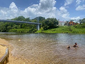
When I stand on the shores of Placencia or the Split at Caye Caulker, I don’t just see water. I see movement. I see memory. I see the trade winds that brought stories, survival, struggle — and the spirit of Belize.
The Caribbean Sea isn’t just a destination.
It’s a mirror — showing who we are, where we’ve come from, and why Belize feels so deeply alive.